Fosse Bridge to Hickling Basin
 The sound of modern traffic on the Fosse Way serves only to confirm the farsightedness and skill of the Roman surveyors. The road that they planned and built here was amongst the first of the major British Roman roads, from Lincoln to Seaton and the port of Exeter in faraway Devon. Following the first ‘push’ of the Roman invasion, northern and northwestern England remained unconquered and this road slicing diagonally across the country was very much a frontier route linking military forts. Remarkably, in a distance of some 200 miles it never varies more than six miles from a straight line.
The surveyor’s art is also evident here in another capacity too. The lock [L11] at Fosse Bridge [B18] marks the beginning of the Grantham Canal at Twenty Mile Pound; ‘pound’ being the word used to describe a stretch of canal between locks. The next lock is indeed 20 miles away near Muston. The OS map shows a 44 metre spot height adjacent to the lock and a comparison of the canal route from this point with the OS map contours reveals the accuracy with which the canal construction was planned, with only minor cuttings and embankment works being needed.
It is worth noting that the towpath on this section is surfaced throughout. Pools of brackish water persist after Fosse Bridge but you are now essentially walking the dry section lasting about 3 miles. The underlying rock is gypsum which is both close to the surface and porous and it was this part of the canal which caused problems during construction and had to be lined (puddled) with clay to prevent seepage. This was the main reason why the eastern section was ready first, and a factor that caused subsequent maintenance problems too. Rules forbade bargemen from using poles for fear of puncturing the canal bed and literally letting the water out.
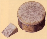
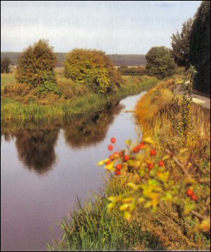
The towpath leads on now to Cropwell Bishop and anyone wishing for a slight change of scenery can use a parallel footpath on the opposite bank. Whether you do this or not, cross over [B19] anyway for a moment and look right. In the valley can be seen a long, oblong lake, the existence of which has been cited as evidence of at least the partial building of a Bingham Canal branch. Both open and overgrown stretches of canal bed encourage a wide variety of plants and birds, with buttercups and dog roses being abundant during spring and early summer.
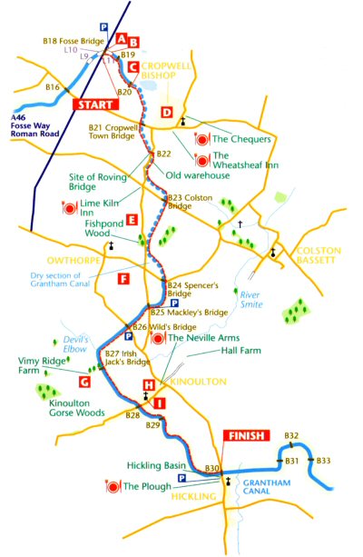
 It is worth the short stroll from Cropwell Town Bridge [B21] into Cropwell Bishop, Dwhere the chance of refreshment beckons with a choice of two inns. On the way into the village is Cropwell Bishop Creamery, one of those where Stilton cheese is made. The company has origins going back to 1847. There is a shop on site, so you could buy a wedge of prime Stilton for your picnic box.
Cropwell takes its name from the Danish ‘Kroppr’ or early English ‘Crop’ for the outcrop of nearby Hoe Hill. The Bishop bit was added in the 10th century when the land was given to the Bishop of York. The church, St. Giles, has 13th and 14th century masonry and many interesting carvings, including weird faced corbels supporting the nave roof, a 14th century font and some pews with poppy head carvings of the same age. There are legends of Dick Turpin lodging in the village; no doubt he was attracted to the vicinity by rich pickings on the nearby Fosse Way.
In the car park by the ‘Town’ bridge is an information board on local history and gypsum mining, an activity that was certainly well established by 1686 when records show that the parson got tithes for ‘plaister’ E. Between here and the next bridge the quarter way point of the canal’s journey to Grantham is reached.
At the next road the towpath swaps sides – and from here the canal remains on your right all the way to Grantham. The low bridge [B22] is also significant in that it replaced the only (and sadly demolished) roving bridge of the canal. A ‘roving’ bridge was specially constructed to allow the towing horse to pass underneath, double back over the bridge and cross to a towpath on the opposite side without having to unhitch from the barge.
Just beyond the roving bridge site stands an old warehouse, believed to be contemporary with the canal. This was originally used to process gypsum and there is a distinct widening where the wharves would have been situated. In this warehouse the rock was crushed to powder and put into sacks before being loaded onto waiting barges. The local gypsum was of a high quality (i.e. very white) and was used for medicinal pills, brewing and plaster of Paris. From 1951 the British Gypsum Company began quarrying for the rock and the underground mines ceased to operate. The three main areas where this quarrying took place are shown on OS maps alongside the canal between Fosse Bridge and Cropwell as ‘Disused Workings’. With only a short break in the 1980s, quarrying continued until 1994.
The gardens of Blue Hill hamlet are reached next. The name comes from the colour of the local clay, mined to puddle the canal bed. There is also limestone hereabouts and at one time several lime kilns stood close to the canal. The importance of this local industry is still recalled by the name of the Lime Kiln Inn at the crossroads near the canal.
At Colston Bridge [B23] a ramp leads to the road. Walk a few paces to your left to another ramp and regain the towpath. The canal here supports large clumps of yellow iris. Views begin to open up now to the Cropwell Wolds in the southwest and on the approach to Spencer’s Bridge [B24] short stretches of open water gradually appear and the irises grow in even more profusion. Spencer’s Bridge is an example of a frequently met canal feature, the naming of bridges and locks after local farmers or landowners (Mackley’s and Wild’s follow on this section alone).
Note another 44 metre spot height. It is near here that a leaking culvert is the primary cause of the ‘dry’ section.
 On the opposite bank stands Fishpond Wood. Unseen behind the wood is the village of Owthorpe where the OS map shows yet more fishponds and moats surrounding this ancient settlement F. Owthorpe, rich in history, lies less than a mile from the canal at Spencer’s Bridge and is worth a detour. Standing amongst meadows at the end of a grass track is St. Margaret’s, rebuilt in 1705 using the original stone. The village is better known as the home of Colonel John Hutchinson, a member of the Long Parliament and a Governor of Nottingham who fought staunchly for Cromwell and the Parliamentarians during the Civil War and became one of the judges who signed Charles Stuart’s death warrant. He built Owthorpe Hall in 1663 near the church, though nothing now remains but gate pillars by the churchyard. The ‘canals’ in Fishpond Wood were dug for Colonel Hutchinson as fishponds and a duck decoy.
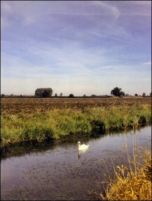
After Spencer’s Bridge a substantial amount of water immediately reappears and the dry section is left behind. A bench invites a rest near a pond with sheltering woodland, then it is on to Mackley’s Bridge [B25] and emergence into open pastures as the path heads for Wild’s Bridge [B26]. The claustrophobic feel of the dry section, often hemmed in by trees, is suddenly gone and a huge arc of hills is seen ahead sweeping round from the west to the northeast and the ridge near Belvoir. Then at the end of a long straight comes the Devil’s Elbow, the sharpest curve on the whole canal. Just round the corner is Irish Jack’s Bridge [B27] and a board telling the story of nearby Vimy Ridge Farm and reason for the planting of the poplar avenue seen leading up the hillside G. Previously Pasture Hill Farm, it was renamed by Sir Jesse Hinde in memory of his son Francis who was killed at the Somme in 1916. The avenue is comprised of 184 trees to commemorate Francis and 183 other members of his regiment – the Sherwood Foresters – who died between July and November during that dreadful battle.
Poplar Tree Memorial, Kinoulton
The whole scene is indeed remarkably reminiscent of a French landscape, even the silhouette of the concrete silo being reminiscent of a distant French church. The avenue has been restored as a Millennium project by Kinoulton Parish Council.
 At Kinoulton there is an opportunity to detour again. The village name is believed to come from an early English woman’s name ‘Cunehilde’ and her ‘Tun’ (farm). There was a castle in the 12th century and a school is known to have existed here since 1289. The Neville Arms by the crossroads, an inn since 1835, is named after the Lincolnshire family from Wellingore into which the daughter of the local Earl of Gainsborough married. On the village green by the inn a turkey oak tree commemorates the Crimean War victory.
It was the Earl who built St. Luke’s in 1793 (the same year that the canal construction began) when the old church on the hillside was abandoned. Inside, the graceful classical style is complemented with an elegant green and white panelled ceiling and green and white window glass. The porch contains a list of vicars since 1264 and a huge coat of arms. There is a west gallery and the organ is contemporary. A local story has it that some of the gravestones from the old churchyard found their way into the fabric of the village bakers oven, a circumstance only discovered when loaves emerged with an ‘In Loving Memory’ imprint. The village is also proud of having produced 30 professional cricketers, one of whom, Will Attewell, played for England.
Beyond Kinoulton Bridge [B28] the basin at Hickling is a mile and a quarter walk. A landscaped area with seats around the basin allows for a well earned rest and the Plough Inn is just across the road.